| 5 °C |
| Vento 2 km/h |
| Pressione atmosferica | 1027 hPa |
| Visibilità | 20 km |
Calcolato dalle stazioni vicine (00:00 01/04/2025)
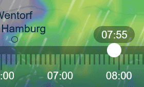
| 01:00 | 02:00 | 03:00 | 04:00 | 05:00 | 06:00 | 07:00 | 08:00 | 09:00 | 10:00 | 11:00 | 12:00 | 13:00 | 14:00 | 15:00 | 16:00 | 17:00 | 18:00 | 19:00 | 20:00 | 21:00 | 22:00 | 23:00 | 00:00 domani | 01:00 domani |
|---|---|---|---|---|---|---|---|---|---|---|---|---|---|---|---|---|---|---|---|---|---|---|---|---|

4 °C
0 mm0 % E
5 km/h
|

4 °C
0 mm0 % SE
6 km/h
|

4 °C
0 mm0 % E
5 km/h
|
4 °C
0 mm0 % E
5 km/h
|
5 °C
0 mm10 % NE
8 km/h
|
5 °C
0 mm20 % E
7 km/h
|
5 °C
0 mm30 % NE
8 km/h
|
6 °C
0 mm30 % NE
8 km/h
|
7 °C
0 mm30 % NE
11 km/h
|
8 °C
0 mm20 % NE
13 km/h
|
10 °C
0 mm20 % NE
13 km/h
|
10 °C
0 mm20 % NE
13 km/h
|
11 °C
0 mm10 % NE
13 km/h
|
11 °C
0 mm20 % NE
14 km/h
|
12 °C
0 mm20 % NE
16 km/h
|
11 °C
0 mm20 % NE
17 km/h
|
11 °C
0 mm10 % NE
16 km/h
|
10 °C
0 mm10 % NE
13 km/h
|
9 °C
0 mm10 % NE
11 km/h
|
9 °C
0 mm0 % NE
10 km/h
|
9 °C
0 mm0 % NE
9 km/h
|
9 °C
0 mm0 % NE
7 km/h
|
8 °C
0 mm0 % NE
6 km/h
|
8 °C
0 mm0 % NE
4 km/h
|
8 °C
0 mm0 % NE
4 km/h
|
| 00:00 | 03:00 | 06:00 | 09:00 | 12:00 | 15:00 | 18:00 | 21:00 |
|---|---|---|---|---|---|---|---|
|
8 °C
0 mm0 % NE
4 km/h
|
7 °C
0 mm20 % E
3 km/h
|

5 °C
0 mm20 % E
3 km/h
|
11 °C
0 mm20 % N
3 km/h
|

12 °C
0 mm10 % NO
8 km/h
|
11 °C
0 mm20 % O
9 km/h
|
10 °C
0 mm30 % SO
8 km/h
|
9 °C
0 mm40 % SO
6 km/h
|
| 24 |
| 13 |
| 2 |
| ma 01 | me 02 | gi 03 | ve 04 | sa 05 | do 06 | lu 07 | ma 08 | me 09 | gi 10 | ve 11 | sa 12 | do 13 | lu 14 |
Air quality index (marked as AQI) is developed by Environmental Protection Agency. Values over 300 represents hazardous air quality, between 200-300 very unhealthy, 150-200 unhealthy, 100-150 unhealthy for sensitive groups and below 100 or rather below 50 the air quality is good.

| Posizione: ↓nord | Ora : 01/04/2025 00:00 |
| Fase: notte | Altitudine: −49 ° |

| Posizione: ↓nordovest | Ora : 01/04/2025 00:00 |
| Parte illuminata: 7 % | Altitudine: −30 ° |
| Data | alba | tramonto | alba | Parte illuminata |
| 01/04/2025 | 07:01 | 21:55 | — | 7 % fino a 14 % |
| 02/04/2025 | 07:43 | 23:11 | — | 14 % fino a 23 % |
| 03/04/2025 | 08:33 | — | — | 23 % fino a 33 % |
| 04/04/2025 | — | 00:20 | 09:32 | 34 % fino a 44 % |
| 05/04/2025 | — | 01:19 | 10:36 | 45 % fino a 55 % |
| Fase 01/04/2025 | Ora | Lunghezza |
| notte | 00:00 fino a 04:13 | 4 ore 14 minuti |
| crepuscolo astronomico | 04:13 fino a 04:45 | 31 minuti |
| crepuscolo nautico | 04:45 fino a 05:15 | 31 minuti |
| crepuscolo civile | 05:15 fino a 05:41 | 26 minuti |
| giorno | 05:41 fino a 18:16 | 12 ore 35 minuti |
| crepuscolo civile | 18:16 fino a 18:42 | 26 minuti |
| crepuscolo nautico | 18:42 fino a 19:12 | 31 minuti |
| crepuscolo astronomico | 19:12 fino a 19:44 | 31 minuti |
| notte | 19:44 fino a 00:00 | 4 ore 16 minuti |
Dati: ICON, DWD (risoluzione 13 km)
Aggiornato: 06:00 UTC (prossimo aggiornamento: 12:00 UTC - in preparazione)
Ora corrente: 16:00, 31/03/2025 (UTC)
For this output data, temperature is shown for 2 m sopra il suolo. The calculations take into account the terrain (elevation), but with lower resolution than in reality. Therefore the models cannot differentiate, for instance, the temperature on a mountain peak or on a city square scorched by the sun. The general rule is that the centres of large cities are 1 °C to 3 °C warmer than the surrounding area or natural landscapes. Significant temperature differences over a small area are primarily caused in the winter by an inversion. A short yet noticeable cooling can also occur after a local summer storm.