

● I-10 EB 255.20 @Miracle Mile 2 km az511.com
● I-10 EB 257.40 @Speedway Blvd 2 km az511.com
● I-10 WB 254.60 @E of Prince Rd 3 km az511.com
● I-10 EB 254.30 @Prince Rd 3 km az511.com
● I-10 WB 258.40 @Congress St 3 km az511.com
● University of Arizona campus from the Computer Science offices in the Gould-Simpson building 4 km camera.cs.arizona.edu
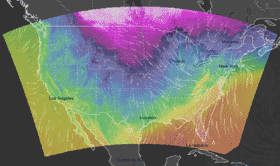
Podaci: HRRR, NOAA (razlučivost 3 km)
Ažurirani: 00:00 UTC (sljedeće ažuriranje: 01:00 UTC - pripremi)
Vrijeme sad: 03:00, 24.03.2025 (UTC)
For this output data, temperature is shown for 2 m iz. nad. vis.. The calculations take into account the terrain (elevation), but with lower resolution than in reality. Therefore the models cannot differentiate, for instance, the temperature on a mountain peak or on a city square scorched by the sun. The general rule is that the centres of large cities are 1 °C to 3 °C warmer than the surrounding area or natural landscapes. Significant temperature differences over a small area are primarily caused in the winter by an inversion. A short yet noticeable cooling can also occur after a local summer storm.